

Our Land analysis relies on the National Land Cover Database (NLCD) to understand how population growth manifests on the landscape.
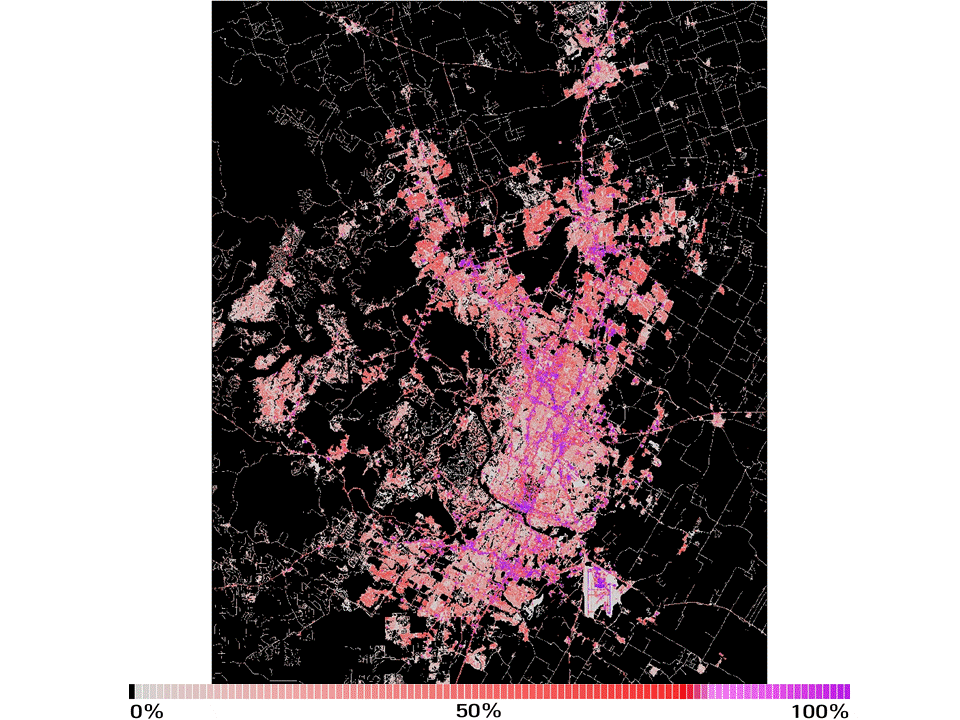
The NLCD uses 30-meter grid for the entire United States to locate different land covers (what type of ecosystem, such as forest, developed, wetland, etc) and the % imperviousness (if water can penetrate the land surface). Below is an animation of the Austin metro, showing the % imperviousness for 2001 to 2016. You can see both where growth has located and how intense it is (the darker, the less water can penetrate).
Texas Land Change by Tract
The dashboard below shows two metrics - Urban Expansion and Intensification - for all tracts in metro Texas.
Expansion occurs when natural or rural lands become developed, the units are arcres. Intensification occurs as the average % imperviousness, or impermeability increases. The former demonstrates where growth is occuring, while the latter gives some indication of the quality of development.
For help downloading the data behind the dashboard, see our help page.
Source: National Land Cover Database